Guana Cay, Pinders, Long Island, Bahamas - The Beaches of Long Island
The Beaches of Long Island
The Beaches of Long Island
Guana Cay, Pinders, Long Island, Bahamas
Near North
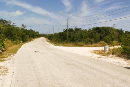
DIRECTIONS: OK, it’s easy to miss the road going to Guana Cay. It used to be: look for the blue barrel with “Darville” on it at the side of the road just before you got to the Salt Pond sign (if going north) or just after the Pinders sign (if going south). Well, its now: look for a somewhat nondescript grey-blue barrel with no name. The road angles to the QH at about 120o going north or 60o going south. Several hundred yards to the north, there are the obvious road remains of what was going to be a development. Look for this as it will tell you if you’re almost there or if you’ve gone too far. The first half mile is over a mix of rutted sand/hard pan. So take it easy. There is a paved section that takes you over the “hump” and then down onto solid sand. Parking is somewhat limited, so it’s best to park for your return trip.

Guana Cay beach, Long Island, Bahamas
Looking north
Looking south

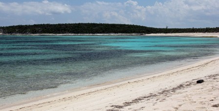
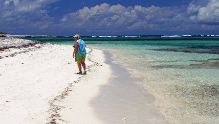
Guana Cay, in our opinion, is THE BEST BEACH on all of Long Island. Sure there’s Dean’s Hole, which is right up there, but...! This is the classic crescent shaped island beach. The views are spectacular. The sand is almost ideal for walking. The water colors cover all the blues. The extensive reefs make for wonderful sea life. The cay provides protection from wind and wave making swimming and snorkeling easy directly behind the cay. However caution is advised at either end of the cay as there is not as much reef protection to reduce wind, wave, and current. At low tide, one can actually wade over to the Cay. At high tide, water depths aren’t intimidating even for a novice snorkeler. And the Cay is home to small iguanas (hence the name) who will scurry down to meet you looking to be fed! There is a nice cabana down by the beach which allows you to sit under the shade and enjoy the view if that’s all you want to do. The cabana is privately owned, but visitors are allowed to use it for sitting. PLEASE DON'T ABUSE THE PRIVILEGE!

From entrance, strolling to the cabana around the bend
View from the cabana
Guana Cay beach, Long Island, Bahamas
A Note on Eastern Harbour: I didn’t include Eastern Harbour in the official list of beaches, mostly because of its inaccessibility: it can only be reached by way of going around the southern point of Guana Cay, whether swimming, kayaking, or walking at low tide. Distances are given on the earthview googlemap. We did get a report back from friends who had visited and their report wasn’t encouraging: at low tide, very shallow and swimming/snorkeling difficult. However, they did report finding one of the loveliest shells they had ever seen. Will update as we get further info or get a chance to visit it ourselves.